The Role of Geoinformatics in Predicting Drought Risk
Introduction
Geoinformatics, a discipline that uses information science infrastructure to address the problems of geography, geosciences and related branches of engineering, plays a crucial role in predicting drought risk. This article delves into the intricacies of this role, exploring the methodologies, technologies, and applications of geoinformatics in drought risk prediction.


Geoinformatics: An Overview
Geoinformatics is an interdisciplinary field that uses the techniques of information science, including data capture, information management, and data analysis, to understand and address geographical problems. The field integrates geospatial analysis and modeling, using geographically referenced datasets and geospatial technologies, such as GIS, remote sensing, and GPS.
Drought Risk: Understanding the Concept
Drought risk refers to the potential for loss or harm in a particular area due to drought conditions. It is a function of both the likelihood of a drought event and the potential impact on human and natural systems. Drought risk is typically assessed using indicators such as precipitation, temperature, soil moisture, and vegetation health.


Role of Geoinformatics in Drought Risk Prediction
Geoinformatics plays a pivotal role in drought risk prediction by providing tools and techniques for data collection, analysis, and interpretation. It enables the integration of various data types, including meteorological, hydrological, and socio-economic data, to generate comprehensive drought risk maps.
Data Collection
Geoinformatics facilitates the collection of spatial and temporal data related to drought indicators. Remote sensing technologies, for example, provide satellite imagery that can be used to monitor vegetation health and soil moisture levels over large areas and over time. Similarly, GIS can be used to capture and manage data on factors such as land use, population density, and water resources, which can influence drought risk.
Data Analysis
Geoinformatics provides powerful tools for analyzing and interpreting drought-related data. GIS, for instance, allows for spatial analysis of data, enabling researchers to identify patterns and trends in drought conditions across different geographical areas. Moreover, geostatistical techniques can be used to model spatial relationships and predict drought risk in unmonitored areas.
Drought Risk Mapping
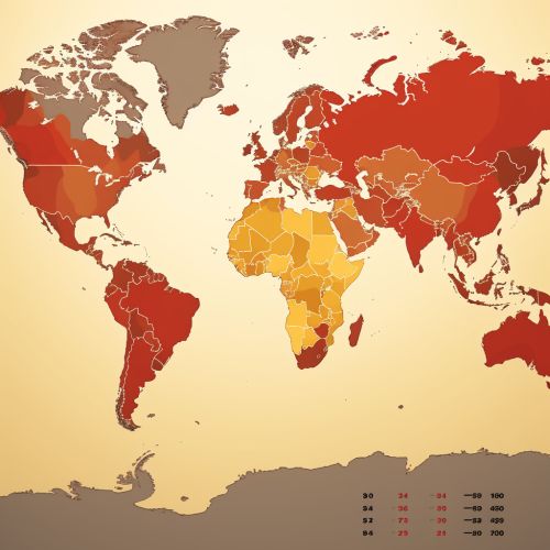
One of the key applications of geoinformatics in drought risk prediction is the creation of drought risk maps. These maps integrate various data layers, such as precipitation, temperature, soil moisture, and vegetation health, to provide a visual representation of drought risk across a given area. Such maps can be used to guide drought management and mitigation efforts.


Challenges and Future Directions
While geoinformatics offers significant potential for drought risk prediction, it also presents several challenges. These include issues related to data availability and quality, the need for advanced technical skills, and the complexity of integrating and interpreting diverse data types.
Looking ahead, the field of geoinformatics is poised to continue evolving and expanding, driven by advances in technology and increasing recognition of the importance of geospatial data in addressing environmental challenges. Future directions may include the development of more sophisticated drought risk models, the integration of geoinformatics with other disciplines such as climatology and hydrology, and the application of new technologies such as machine learning and artificial intelligence in drought risk prediction.
