ELORAN
Overview
ELORAN (Enhanced Long Range Navigation) is a ground-based navigation system that utilizes low-frequency radio signals. It was developed in the United States during the mid-20th century as a long-range navigation method for marine and aviation applications. The system operates by broadcasting a signal from multiple transmitters, which are then received by an ELORAN receiver on a vessel or aircraft. The time delay between the received signals is used to calculate the receiver's position.


History
The development of ELORAN began in the 1940s as an extension of the earlier LORAN (Long Range Navigation) system. The original LORAN system was developed during World War II to provide a reliable method of long-range navigation for military aircraft and ships. However, the original LORAN system had several limitations, including a relatively short range and susceptibility to interference. In response to these limitations, the U.S. Coast Guard began development of an enhanced version of the system, which became known as ELORAN.
ELORAN was officially introduced in the 1970s and was intended to provide a more reliable and accurate navigation system than its predecessor. The system was initially used primarily by the military, but it was later adopted for civilian use as well.
Despite its advantages, ELORAN was eventually phased out in favor of satellite-based navigation systems such as the Global Positioning System (GPS). The last ELORAN station in the United States was shut down in 2010. However, there has been recent interest in reviving the system as a backup to GPS, due to concerns about the vulnerability of satellite-based systems to various forms of interference.
Operation
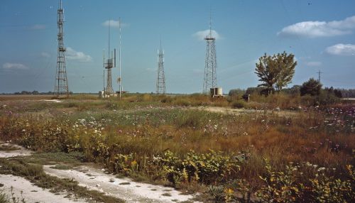
ELORAN operates by broadcasting a signal from a network of ground-based transmitters. These transmitters are located at various points around the world, and each one broadcasts a unique signal. An ELORAN receiver on a vessel or aircraft picks up these signals and uses the time delay between them to calculate its position.
The signals broadcast by ELORAN transmitters are in the low-frequency (LF) range, which allows them to propagate over long distances and penetrate many types of interference. This makes ELORAN a reliable navigation system even in conditions where other systems may fail.
Technical Details
Each ELORAN transmitter broadcasts a signal that consists of a series of pulses. These pulses are precisely timed and follow a specific pattern, which allows the receiver to identify the signal from each transmitter.
The receiver calculates its position by measuring the time delay between the signals from multiple transmitters. This process, known as multilateration, allows the receiver to determine its position with a high degree of accuracy.
In addition to the basic navigation function, ELORAN also provides a time and frequency standard. The signals broadcast by the ELORAN transmitters are precisely timed, and can be used as a reference for timing and frequency measurements.
Current Status and Future Prospects
Although ELORAN was officially decommissioned in the United States in 2010, there has been recent interest in reviving the system. This interest has been driven by concerns about the vulnerability of GPS and other satellite-based navigation systems to various forms of interference, including jamming and spoofing.
In response to these concerns, several countries, including the United States and South Korea, have begun exploring the possibility of re-establishing ELORAN as a backup to GPS. These efforts are still in the early stages, but they reflect a growing recognition of the need for a robust and reliable backup to satellite-based navigation systems.
