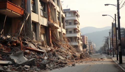
The Role of Geostatistics in Predicting Earthquake Risk
Introduction
Geostatistics is a branch of statistics that deals with spatial or spatiotemporal datasets. It has been extensively used in a variety of fields such as mining, hydrogeology, and environmental science. One of the less known but highly significant applications of geostatistics is in predicting earthquake risk. This article delves into the role of geostatistics in predicting earthquake risk, providing a comprehensive and detailed account of the subject.


Geostatistics: An Overview
Geostatistics originated from the mining and petroleum industry, and has since found applications in diverse fields. It involves the collection, analysis, and interpretation of data that are distributed in space and time. The primary aim of geostatistics is to predict the values of a random field at unobserved locations, based on observations at known locations. This is achieved through a variety of statistical techniques, including kriging, variogram analysis, and spatial autocorrelation.
Earthquake Prediction: The Basics
Earthquake prediction is a branch of the science of seismology concerned with the specification of the time, location, and magnitude of future earthquakes within stated limits. Despite the complexity and inherent randomness of earthquake occurrences, scientists have made significant strides in predicting earthquake risks using various methods, including geostatistical analysis.


Role of Geostatistics in Predicting Earthquake Risk
Geostatistics plays a crucial role in predicting earthquake risk by providing a statistical framework for analyzing spatially correlated data. This is particularly useful in earthquake prediction as seismic activities often show strong spatial correlation.
Spatial Correlation and Variogram Analysis
In geostatistics, the concept of spatial correlation is fundamental. It refers to the degree of dependency between observations based on their spatial locations. In the context of earthquake prediction, spatial correlation could refer to the likelihood of an earthquake occurring in a particular region based on the seismic activities recorded in nearby areas.
Variogram analysis is a geostatistical tool used to quantify spatial correlation. It provides a measure of the degree of spatial dependence as a function of distance and direction. In earthquake prediction, variogram analysis can be used to identify patterns in seismic activity, which can then be used to predict future earthquakes.


Kriging: A Key Geostatistical Technique
Kriging is a key geostatistical technique used in earthquake prediction. Named after the South African mining engineer Danie Krige, kriging is a method of interpolation that takes into account the spatial correlation of data. In earthquake prediction, kriging can be used to estimate the magnitude of an impending earthquake based on seismic data from surrounding areas.
Challenges and Limitations
While geostatistics provides a powerful tool for predicting earthquake risk, it is not without its challenges and limitations. One of the main challenges is the inherent uncertainty associated with earthquake prediction. Despite the use of sophisticated statistical techniques, the prediction of earthquakes remains a probabilistic endeavor.
Another challenge is the quality and quantity of data available. Geostatistical analysis requires a large amount of high-quality data to produce reliable results. However, in many parts of the world, especially in developing countries, the availability of such data is often limited.


Conclusion
Geostatistics plays a pivotal role in predicting earthquake risk. Through techniques such as variogram analysis and kriging, geostatistics provides a statistical framework for analyzing and interpreting spatially correlated data, which is crucial in predicting the likelihood and magnitude of earthquakes. Despite its challenges and limitations, geostatistics remains a key tool in the arsenal of seismologists and earthquake engineers worldwide.
