Spatial Distribution
Introduction
Spatial distribution refers to the arrangement of a phenomenon across the Earth's surface. It is a fundamental concept in the field of geography that describes how physical or human phenomena are distributed and the patterns they form. Spatial distribution can be examined at a variety of scales, from the local to the global, and can be influenced by a range of factors, including natural processes, human activities, and the interaction between the two.
Types of Spatial Distribution
There are three main types of spatial distribution: uniform, random, and clustered.
Uniform Distribution


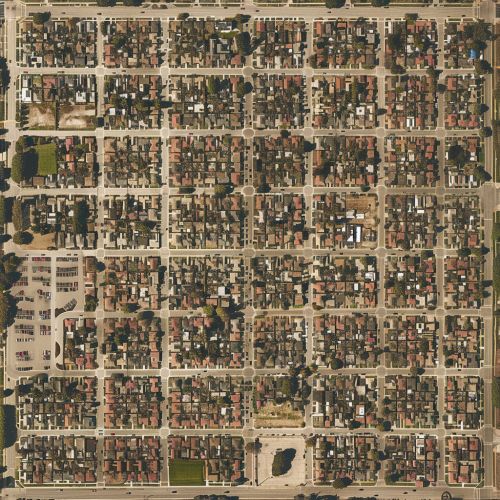
Uniform distribution, also known as even distribution, occurs when objects are evenly spaced across an area. This type of distribution is often the result of human planning or intervention, such as the grid-like layout of many cities or the evenly spaced rows of crops in a field.
Random Distribution
Random distribution occurs when the location of objects in an area is not influenced by the location of other objects. This type of distribution is often seen in nature, such as the distribution of trees in a forest or the distribution of stars in the sky.
Clustered Distribution
Clustered distribution, also known as aggregated distribution, occurs when objects are grouped together in certain areas. This type of distribution can be seen in both human and natural phenomena, such as the clustering of buildings in a city or the grouping of plants in a particular habitat.
Factors Influencing Spatial Distribution
The spatial distribution of a phenomenon is influenced by a variety of factors, including physical characteristics of the environment, human activities, and interactions between the two.
Physical Factors
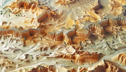
Physical factors such as climate, topography, and soil type can significantly influence the spatial distribution of both natural and human phenomena. For example, the distribution of plant species is largely determined by the physical conditions of their environment, while the distribution of human settlements is often influenced by factors such as access to water and the suitability of the land for agriculture or construction.
Human Factors
Human activities also play a significant role in shaping spatial distribution. Economic activities, cultural practices, political decisions, and technological advancements can all influence the distribution of phenomena across the Earth's surface. For example, the distribution of industries may be influenced by access to resources, labor, and markets, while the distribution of languages may be shaped by historical migration patterns and cultural exchanges.
Interactions
The interaction between physical and human factors can also influence spatial distribution. For example, the distribution of agricultural activities is often a result of both the physical suitability of the land and the economic and technological capabilities of the farmers. Similarly, the distribution of urban areas is often influenced by both the natural characteristics of the location and the social, economic, and political decisions of the inhabitants and planners.
Studying Spatial Distribution
The study of spatial distribution is a key aspect of many disciplines, including geography, ecology, sociology, and economics. Various methods and tools are used to analyze and visualize spatial distribution, including maps, statistical analysis, and Geographic Information Systems (GIS).
Maps


Maps are one of the most common tools used to represent spatial distribution. They can depict the distribution of a wide range of phenomena, from physical features such as mountains and rivers, to human features such as cities and roads, to abstract concepts such as population density or climate zones.
Statistical Analysis
Statistical analysis can be used to quantify spatial distribution and identify patterns and trends. Measures such as mean center, standard deviation ellipse, and Moran's I can be used to describe the distribution of a phenomenon and assess the degree of clustering or dispersion.
Geographic Information Systems
Geographic Information Systems (GIS) are computer-based tools that allow for the storage, analysis, and visualization of spatial data. GIS can be used to analyze spatial distribution in a variety of ways, including overlay analysis, buffer analysis, and spatial interpolation.
Applications of Spatial Distribution
Understanding spatial distribution has a wide range of applications, from urban planning and environmental management to marketing and public health.
Urban Planning
In urban planning, understanding the spatial distribution of various features, such as population, land use, and infrastructure, can help planners make informed decisions about where to locate new developments, how to manage traffic flow, and where to provide public services.
Environmental Management
In environmental management, understanding the spatial distribution of species, habitats, and environmental conditions can help managers make informed decisions about conservation strategies, habitat restoration, and resource management.
Marketing
In marketing, understanding the spatial distribution of customers, competitors, and market conditions can help businesses make informed decisions about where to locate stores, how to target advertising, and where to focus sales efforts.
Public Health
In public health, understanding the spatial distribution of diseases, health services, and social determinants of health can help health officials make informed decisions about disease control strategies, health service provision, and health promotion efforts.
