Coastline Paradox
Introduction
The **Coastline Paradox** is a fascinating phenomenon in geography and mathematics that highlights the complexities involved in measuring the length of a coastline. It reveals that the length of a coastline can vary dramatically depending on the scale or resolution of measurement used. This paradox challenges traditional notions of measurement and has implications for various fields such as cartography, fractal geometry, and environmental science.
The Nature of the Paradox
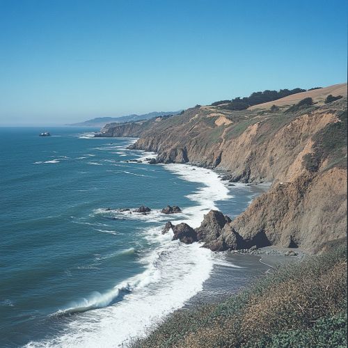
The Coastline Paradox arises from the observation that coastlines are not smooth, linear features but are instead highly irregular and fractal-like. When attempting to measure the length of a coastline, the result depends on the length of the measuring stick or unit used. As the unit of measurement becomes smaller, the measured length of the coastline increases. This is because smaller measuring units can capture more of the intricate details and indentations of the coastline.
The paradox was first popularized by mathematician Benoît Mandelbrot in 1967, who used it to illustrate the concept of fractals. Mandelbrot demonstrated that coastlines exhibit a property known as self-similarity, meaning they appear similar at different scales. This self-similarity is a hallmark of fractal geometry, a field that Mandelbrot helped to establish.
Fractal Geometry and Coastlines
Fractal geometry provides a framework for understanding the Coastline Paradox. Unlike Euclidean geometry, which deals with shapes that have integer dimensions, fractal geometry describes objects with non-integer dimensions. The dimension of a fractal object, known as the fractal dimension, is a measure of its complexity and detail.
For coastlines, the fractal dimension typically falls between 1 and 2. A perfectly smooth line has a dimension of 1, while a completely filled plane has a dimension of 2. The fractal dimension of a coastline reflects its irregularity; the more convoluted the coastline, the higher its fractal dimension.
The concept of fractal dimension helps explain why the measured length of a coastline increases as the measurement scale decreases. At smaller scales, more of the coastline's intricate features are captured, leading to a longer measured length.
Implications for Cartography
The Coastline Paradox has significant implications for cartography, the science and art of map-making. Cartographers must decide on an appropriate scale for their maps, balancing the need for detail with the practical limitations of map size and readability. The paradox highlights the challenge of representing complex, real-world features like coastlines on maps.
One approach to addressing the paradox in cartography is to use a standardized scale for measuring coastlines. This allows for consistent comparisons between different coastlines or the same coastline over time. However, this approach does not fully resolve the paradox, as the choice of scale still affects the measured length.
The paradox also underscores the importance of understanding the limitations of maps and the potential for distortion. Maps are inherently simplifications of reality, and the Coastline Paradox is a reminder of the complexities involved in representing the natural world.
Environmental and Scientific Implications
Beyond cartography, the Coastline Paradox has implications for environmental science and coastal management. Accurate measurements of coastline length are important for assessing coastal erosion, habitat loss, and the impacts of climate change. The paradox highlights the need for careful consideration of measurement methods and scales in these contexts.
In environmental science, the fractal nature of coastlines can influence ecological processes. For example, the complexity of a coastline can affect the distribution of habitats and species, as well as the movement of water and sediment. Understanding the fractal properties of coastlines can provide insights into these processes and inform conservation efforts.
Mathematical Models and Measurement Techniques
Several mathematical models and techniques have been developed to address the challenges posed by the Coastline Paradox. One approach is to use box-counting, a method for estimating the fractal dimension of a coastline. This technique involves overlaying a grid of boxes on a map of the coastline and counting the number of boxes that contain part of the coastline. By varying the size of the boxes, researchers can estimate the fractal dimension and gain insights into the coastline's complexity.
Another approach is to use Hausdorff dimension, a more sophisticated measure of fractal dimension that accounts for the scaling behavior of the coastline. The Hausdorff dimension provides a more accurate representation of the coastline's fractal properties, but it is also more complex to calculate.
These mathematical models and techniques are valuable tools for researchers studying coastlines and their properties. They provide a framework for understanding the Coastline Paradox and offer insights into the underlying geometry of natural features.
Case Studies and Examples
The Coastline Paradox can be observed in coastlines around the world. One well-known example is the coastline of Great Britain, which was used by Mandelbrot in his original work on the paradox. Depending on the scale of measurement, the length of Great Britain's coastline can vary significantly, illustrating the fractal nature of coastlines.
Other examples include the coastlines of Norway, with its intricate fjords, and the rugged coastline of Alaska. These regions exhibit high fractal dimensions, reflecting their complex and irregular shapes. The Coastline Paradox is not limited to natural coastlines; it can also be observed in artificial structures like the boundaries of urban areas or the edges of lakes and rivers.
Conclusion
The Coastline Paradox is a compelling example of the complexities involved in measuring natural features. It challenges traditional notions of measurement and highlights the importance of scale and resolution. The paradox has implications for a wide range of fields, from cartography and environmental science to mathematics and geography.
Understanding the Coastline Paradox requires an appreciation of fractal geometry and the intricate nature of coastlines. By exploring the paradox, researchers can gain insights into the underlying geometry of natural features and the challenges of representing them accurately.


