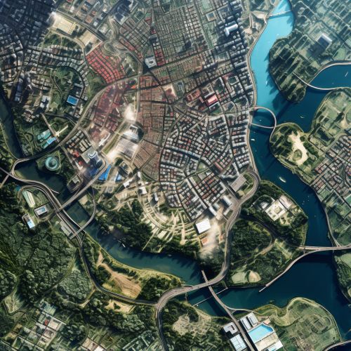
The Role of Geospatial Analysis in Urban Planning
Introduction
Geospatial analysis is a comprehensive approach that involves the collection, display, and manipulation of imagery, GPS, satellite photography and historical data, described explicitly in terms of geographic coordinates or implicitly, in terms of a street address, postal code, or forest stand identifier. It plays a crucial role in urban planning, a technical and political process concerned with the use of land and design of the urban environment, including transportation networks, to guide and ensure the orderly development of settlements and communities.


The Role of Geospatial Analysis in Urban Planning
Geospatial analysis is a powerful tool used in urban planning for various purposes. It provides a visual representation of data that can be used to analyze and interpret patterns and trends in spatial data, which is critical in urban planning.
Data Collection and Analysis
In urban planning, data collection and analysis are crucial steps. Geospatial analysis helps in collecting data about the physical and social characteristics of urban areas. This data can include information about the population, infrastructure, land use, and environmental conditions. The collected data is then analyzed to identify patterns and trends, which can guide decision-making in urban planning.


Land Use Planning
Land use planning is a key component of urban planning. It involves determining the best use of land and resources to meet the needs of the community. Geospatial analysis can provide valuable insights into land use patterns, which can inform land use planning decisions. For example, it can help identify areas of high residential density, commercial activity, or green space.


Infrastructure Planning
Infrastructure planning involves the design and placement of infrastructure such as roads, bridges, utilities, and public facilities. Geospatial analysis can provide a detailed understanding of the existing infrastructure and identify gaps or areas of need. This can help planners make informed decisions about where to invest in new infrastructure.


Environmental Planning
Environmental planning involves the management and protection of natural resources and the environment. Geospatial analysis can provide valuable information about the environment, such as the location of protected areas, the distribution of species, and the impacts of human activities on the environment. This information can guide environmental planning decisions and help ensure the sustainable development of urban areas.


Transportation Planning
Transportation planning involves the design and management of transportation systems. Geospatial analysis can provide insights into transportation patterns, such as traffic flows and public transit usage. This information can guide transportation planning decisions, such as where to build new roads or transit lines.


Benefits of Geospatial Analysis in Urban Planning
Geospatial analysis offers numerous benefits in urban planning. It allows for a more efficient and effective planning process by providing accurate and detailed information about urban areas. This can lead to better decision-making and more sustainable urban development.


Challenges and Limitations
Despite its benefits, geospatial analysis also has some challenges and limitations. These include the need for high-quality data, the complexity of spatial analysis techniques, and the need for skilled personnel to conduct the analysis. Despite these challenges, the use of geospatial analysis in urban planning is expected to continue to grow in the future.


Conclusion
Geospatial analysis plays a crucial role in urban planning. It provides valuable data and insights that can guide decision-making and contribute to the sustainable development of urban areas. Despite some challenges, it is a powerful tool that can enhance the effectiveness of urban planning.
