Mappa Mundi
Introduction
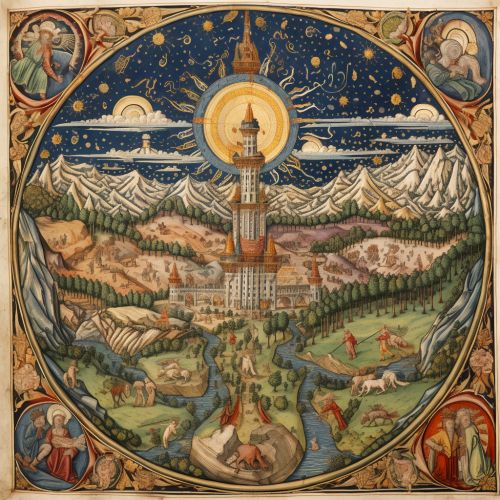
The Mappa Mundi is a term derived from Latin, with 'mappa' meaning cloth or chart, and 'mundi' signifying the world. The term is used to refer to medieval European maps of the world, which were often drawn on cloth or parchment. These maps, unlike modern geographical maps, were intended to illustrate different principles, including religious beliefs, classical knowledge, and contemporary social attitudes, rather than to provide an accurate geographical representation Medieval European Maps of the World.
Historical Context
The Mappa Mundi were created during a period in history when religious beliefs heavily influenced every aspect of life, including the understanding and representation of the world. The maps were not intended for navigation but were instead used as tools for teaching and contemplation, often illustrating biblical events, exotic animals, and monstrous races believed to inhabit the far corners of the Earth Medieval Cartography and Its Religious Influences.
Design and Symbolism
The design of Mappa Mundi often placed Jerusalem at the center of the map, reflecting its spiritual significance in Christian belief. The East, associated with the Garden of Eden and the rising sun, was typically placed at the top of the map. The known world, comprising Asia, Africa, and Europe, was usually depicted within a circular format, symbolizing the belief in a finite and enclosed Earth Significance of Jerusalem in Medieval Maps.

Notable Mappa Mundi
There are several notable Mappa Mundi that have survived to the present day, each with its unique characteristics and features.
Hereford Mappa Mundi
The Hereford Mappa Mundi, housed in the Hereford Cathedral in England, is the largest surviving Mappa Mundi. It dates back to around 1300 and measures 1.58 by 1.34 meters. The map is drawn on a single sheet of vellum and features over a thousand drawings of towns, animals, and people, as well as biblical events Hereford Mappa Mundi.


Ebstorf Mappa Mundi
The Ebstorf Mappa Mundi was a large map believed to have been created in the 13th century. It was destroyed during World War II, but photographs and descriptions of the map remain. The Ebstorf map was unique in that it depicted the world as a round disc with Christ's head, hands, and feet at the edges, symbolizing his presence in the world Ebstorf Mappa Mundi.
Conclusion
The Mappa Mundi are remarkable artifacts that provide insight into the medieval worldview. They are not just maps, but also encyclopedias of the medieval mind, filled with a mixture of religious beliefs, classical knowledge, and contemporary social attitudes. Studying these maps allows us to understand the complexities and nuances of the medieval world, as well as the evolution of cartography and geographical understanding.
