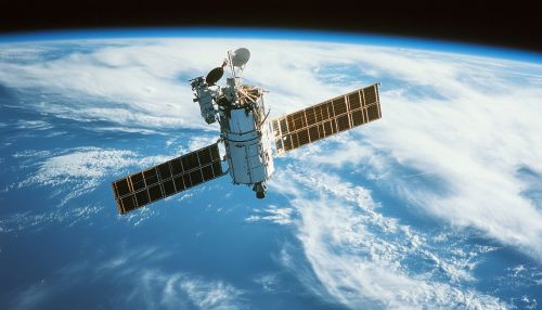
Geostationary Operational Environmental Satellite (GOES)
Introduction
The Geostationary Operational Environmental Satellite (GOES) program is a series of geostationary weather satellites operated by the NOAA. These satellites are a critical component of the United States' weather monitoring and forecasting capabilities. Positioned in geostationary orbit, they provide real-time data crucial for weather prediction, environmental monitoring, and climate research. The GOES program has evolved significantly since its inception, incorporating advanced technologies to enhance data accuracy and coverage.
Historical Development
The GOES program began in the 1970s, with the launch of GOES-1 in 1975. This marked the United States' entry into geostationary weather satellite operations, following the success of the Television Infrared Observation Satellite series. The early GOES satellites were spin-stabilized and equipped with basic meteorological instruments. Over the decades, the program has undergone several iterations, each introducing technological advancements that improved data resolution and reliability.
GOES-N Series
The GOES-N series, launched between 2006 and 2010, represented a significant leap in satellite technology. These satellites featured three-axis stabilization, allowing for more precise imaging and data collection. They were equipped with advanced instruments such as the Imager and Sounder, which provided high-resolution data for weather forecasting and atmospheric research.
GOES-R Series
The GOES-R series, initiated with the launch of GOES-16 in 2016, marked a new era in geostationary weather observation. These satellites introduced the Advanced Baseline Imager (ABI), which offers 16 spectral bands, compared to the 5 bands of previous models. This enhancement allows for more detailed observation of atmospheric phenomena and improved monitoring of severe weather events.


Technical Specifications
The GOES satellites are positioned in geostationary orbit, approximately 35,786 kilometers above the equator. This orbit allows them to maintain a constant view of the same Earth region, providing continuous monitoring capabilities. The satellites are equipped with a suite of instruments designed for various meteorological and environmental applications.
Advanced Baseline Imager (ABI)
The ABI is the primary instrument on the GOES-R series, capable of capturing high-resolution imagery across 16 spectral bands. This instrument provides data on cloud cover, atmospheric temperature, moisture profiles, and surface conditions. The ABI's rapid scanning capabilities enable near-real-time monitoring of weather systems, crucial for timely forecasting and warning dissemination.
Geostationary Lightning Mapper (GLM)
Another key instrument on the GOES-R series is the Geostationary Lightning Mapper (GLM). The GLM is the first operational lightning mapper flown in geostationary orbit, capable of detecting and mapping lightning activity across the Americas. This data is vital for understanding storm dynamics and improving severe weather forecasts.
Space Environment In-Situ Suite (SEISS)
The SEISS monitors the near-Earth space environment, providing data on solar and geomagnetic activity. This information is essential for assessing space weather impacts on satellite operations, communication systems, and power grids.
Applications and Impact
The data provided by the GOES satellites is indispensable for a wide range of applications. Meteorologists rely on GOES data for accurate weather forecasting, including the prediction of hurricanes, thunderstorms, and other severe weather events. The continuous monitoring capabilities of GOES satellites enable the timely issuance of warnings, helping to mitigate the impact of natural disasters.
Environmental Monitoring
Beyond weather forecasting, GOES satellites play a crucial role in environmental monitoring. They provide data on ocean temperatures, vegetation health, and atmospheric pollutants, contributing to climate research and environmental management efforts.
Climate Research
GOES data is also used in climate research, offering insights into long-term atmospheric trends and variability. The high-resolution imagery and comprehensive data sets support studies on climate change, aiding in the development of mitigation and adaptation strategies.
Future Developments
The GOES program continues to evolve, with plans for future satellite launches and technological advancements. The next generation of GOES satellites is expected to incorporate even more sophisticated instruments, enhancing data quality and expanding observational capabilities. These advancements will further improve weather forecasting accuracy and environmental monitoring efforts.
