Active remote sensing
Introduction
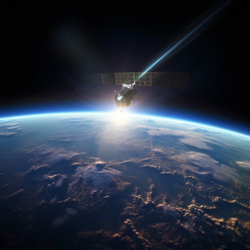
Active remote sensing is a type of remote sensing that involves the emission and detection of radiation from a sensor located on a satellite or an aircraft. The sensor emits a signal towards the Earth's surface and measures the energy that is reflected back. This method is different from passive remote sensing, which relies on naturally occurring energy, such as sunlight or thermal radiation.
Principles of Active Remote Sensing
Active remote sensing systems operate by generating a signal, such as a pulse of light or sound, and then measuring the signal that is reflected back to the sensor. The time it takes for the signal to return to the sensor can be used to calculate the distance to the object, while the strength of the returned signal can provide information about the object's characteristics.
The main components of an active remote sensing system include a transmitter, which generates the signal; a receiver, which detects the returned signal; and a processing system, which interprets the data.
Types of Active Remote Sensing
There are several types of active remote sensing, including radar, lidar, and sonar, each of which uses a different type of signal.
Radar
Radar (Radio Detection and Ranging) uses radio waves to detect and locate objects. It is commonly used in meteorology to track storms and in aviation to detect aircraft. In remote sensing, radar can be used to map the Earth's surface and to detect changes in the environment.
Lidar
Lidar (Light Detection and Ranging) uses laser light to measure distances. It is often used in geology and forestry to create high-resolution maps of the Earth's surface, and in atmospheric science to measure the composition and structure of the atmosphere.
Sonar
Sonar (Sound Navigation and Ranging) uses sound waves to detect and locate objects underwater. It is commonly used in oceanography to map the seafloor and to detect underwater features.
Applications of Active Remote Sensing
Active remote sensing has a wide range of applications, including environmental monitoring, resource management, and military surveillance.
Environmental Monitoring
Active remote sensing can be used to monitor changes in the environment, such as deforestation, urban growth, and climate change. For example, radar can be used to detect changes in vegetation cover, while lidar can be used to measure changes in the Earth's surface.
Resource Management
Active remote sensing can also be used to manage natural resources. For example, sonar can be used to map the seafloor and locate underwater resources, while radar and lidar can be used to map and monitor forests and agricultural lands.
Military Surveillance
In the military, active remote sensing is used for surveillance and reconnaissance. Radar, for example, can be used to detect and track aircraft and missiles, while lidar can be used to create detailed maps of the terrain.
Advantages and Disadvantages of Active Remote Sensing
Like all technologies, active remote sensing has its advantages and disadvantages.
Advantages
One of the main advantages of active remote sensing is that it can operate in any lighting conditions, unlike passive remote sensing, which relies on sunlight. This means that active remote sensing can be used at night and in cloudy conditions.
Another advantage is that active remote sensing can provide very accurate measurements. For example, lidar can measure distances with an accuracy of a few centimeters, while radar can detect changes in the Earth's surface of less than a centimeter.
Disadvantages
One of the main disadvantages of active remote sensing is that it can be affected by the atmosphere. For example, rain can scatter the signal and reduce the accuracy of the measurements.
Another disadvantage is that active remote sensing systems are generally more complex and expensive than passive systems. They require a power source to generate the signal, and the equipment is often more sophisticated.
Future of Active Remote Sensing
The future of active remote sensing looks promising, with advances in technology leading to more accurate and efficient systems. For example, improvements in laser technology are leading to more powerful and efficient lidar systems, while advances in signal processing are improving the accuracy of radar measurements.
At the same time, the increasing availability of satellite data is opening up new opportunities for remote sensing. For example, the European Space Agency's Sentinel program is providing free access to a wealth of radar and lidar data, which is being used by researchers around the world to study the Earth's environment.
See Also


