Wilkes Land
Geographical Overview
Wilkes Land is a large region of Antarctica, extending from 100°E to 142°E. It is named after the American explorer Charles Wilkes, who led the United States Exploring Expedition (1838–1842) and is credited with confirming the existence of the Antarctic landmass. This region is part of the Australian Antarctic Territory and is primarily covered by the East Antarctic Ice Sheet.


Physical Geography
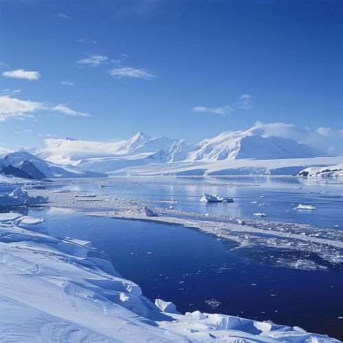
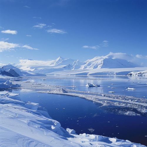
Wilkes Land is characterized by its extensive ice cover, which includes both the East Antarctic Ice Sheet and several prominent ice shelves. The region's topography beneath the ice is varied, with mountain ranges, subglacial lakes, and deep valleys. Notable features include the Adélie Coast, the George V Coast, and the Oates Coast. The region also contains the Wilkes Subglacial Basin, a large, deep depression beneath the ice.
Ice Sheets and Glaciers
The East Antarctic Ice Sheet, which covers Wilkes Land, is one of the two major ice sheets in Antarctica. It is thicker and more stable than the West Antarctic Ice Sheet. The ice sheet flows outward from the interior of the continent towards the coast, feeding numerous glaciers and ice streams. Significant glaciers in Wilkes Land include the Totten Glacier, one of the largest and fastest-flowing glaciers in East Antarctica, and the Mertz Glacier.
Subglacial Lakes
Wilkes Land is home to several subglacial lakes, which are bodies of water trapped beneath the ice sheet. These lakes are of great scientific interest because they may contain unique ecosystems isolated for millions of years. Lake Vostok, located near the boundary of Wilkes Land, is one of the largest and most well-studied subglacial lakes in Antarctica.
Climate
The climate of Wilkes Land is typical of the Antarctic continent, characterized by extremely cold temperatures, strong katabatic winds, and low precipitation. The coastal areas experience milder temperatures and higher snowfall compared to the interior. The region's climate is influenced by the Antarctic Circumpolar Current and the Southern Ocean.
Geological History
Wilkes Land has a complex geological history that dates back to the Precambrian era. The region was once part of the supercontinent Gondwana, which began to break apart around 180 million years ago. The geological structure of Wilkes Land includes ancient cratons, metamorphic rocks, and sedimentary basins. The region has also been shaped by tectonic activity, including the formation of rift valleys and volcanic activity.
Scientific Research
Wilkes Land is a focal point for scientific research in Antarctica. Studies in the region cover a wide range of disciplines, including glaciology, geology, climatology, and biology. Research stations such as Dumont d'Urville Station and Casey Station serve as bases for scientists conducting fieldwork in the area. Key research topics include ice sheet dynamics, climate change, and the unique ecosystems of subglacial lakes.
Ice Core Drilling
One of the most significant scientific activities in Wilkes Land is ice core drilling. Ice cores provide valuable records of past climate conditions, including temperature, atmospheric composition, and volcanic activity. The EPICA Dome C ice core, drilled in the nearby Dome C region, has provided climate records dating back over 800,000 years.
Marine Biology
The coastal waters of Wilkes Land are rich in marine life, including krill, fish, and marine mammals. Research in marine biology focuses on understanding the ecosystems of the Southern Ocean and the impact of environmental changes on these ecosystems. Studies of the Ross Sea and the Southern Ocean contribute to our knowledge of Antarctic marine biodiversity.
Human Activity
Human activity in Wilkes Land is primarily related to scientific research and exploration. The region has no permanent human population, and all activities are regulated by the Antarctic Treaty System. The treaty ensures that Antarctica is used for peaceful purposes and promotes international cooperation in scientific research.
Historical Expeditions
Wilkes Land has a rich history of exploration, beginning with the United States Exploring Expedition led by Charles Wilkes. Subsequent expeditions by explorers such as Douglas Mawson and Richard E. Byrd contributed to the mapping and understanding of the region. These early expeditions laid the groundwork for modern scientific research in Antarctica.
Modern Research Stations
Several research stations operate in or near Wilkes Land, providing support for scientific missions. Casey Station, operated by the Australian Antarctic Division, is one of the main research hubs in the region. Other stations, such as Dumont d'Urville Station (France) and Mirny Station (Russia), also play crucial roles in Antarctic research.
Environmental Concerns
Wilkes Land, like the rest of Antarctica, faces environmental challenges related to climate change and human activity. The melting of glaciers and ice shelves due to rising temperatures poses a significant threat to global sea levels. Additionally, the region's unique ecosystems are vulnerable to disturbances from scientific and logistical operations.
Climate Change Impact
The impact of climate change on Wilkes Land is a major area of concern. The melting of the Totten Glacier and other ice masses in the region contributes to global sea level rise. Scientists are studying the mechanisms of ice loss and the potential long-term effects on the Antarctic ice sheet.
Conservation Efforts
Efforts to protect the environment of Wilkes Land are guided by the Antarctic Treaty System and the Protocol on Environmental Protection to the Antarctic Treaty. These agreements establish guidelines for minimizing human impact and preserving the continent's ecological integrity. Research stations are required to follow strict environmental protocols to reduce their footprint.
