Virunga Mountains
Introduction
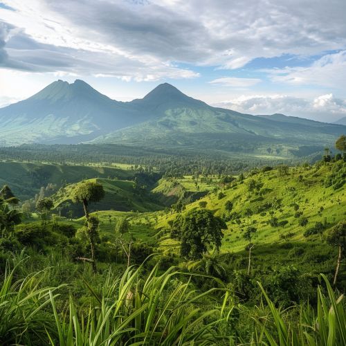
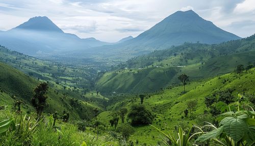
The Virunga Mountains are a chain of volcanoes in East Africa, straddling the borders of the Democratic Republic of the Congo (DRC), Rwanda, and Uganda. This mountain range is part of the Albertine Rift, the western branch of the East African Rift, and is known for its rich biodiversity and significant geological features. The Virunga Mountains are home to some of the world's last remaining mountain gorillas and are a critical area for conservation efforts.
Geographical Overview
The Virunga Mountains stretch approximately 80 kilometers along the borders of the DRC, Rwanda, and Uganda. The range consists of eight major volcanoes, which are divided into two groups: the northern and southern clusters. The northern cluster includes Mount Karisimbi, Mount Mikeno, Mount Bisoke, and Mount Sabyinyo. The southern cluster comprises Mount Nyiragongo, Mount Nyamuragira, Mount Gahinga, and Mount Muhabura.


Major Peaks
- Mount Karisimbi is the highest peak in the Virunga Mountains, standing at 4,507 meters (14,787 feet). It is a dormant volcano located on the border between Rwanda and the DRC.
- Mount Nyiragongo is one of the most active volcanoes in the world, with a height of 3,470 meters (11,385 feet). It is famous for its large lava lake.
- Mount Nyamuragira is another highly active volcano, reaching 3,058 meters (10,033 feet). It has erupted more than 40 times since 1885.
- Mount Mikeno stands at 4,437 meters (14,560 feet) and is known for its rugged terrain and steep slopes.
- Mount Bisoke is a dormant volcano with a height of 3,711 meters (12,175 feet) and features a crater lake at its summit.
- Mount Sabyinyo is an extinct volcano, 3,634 meters (11,923 feet) high, known for its jagged peaks.
- Mount Gahinga is a dormant volcano, 3,474 meters (11,398 feet) tall, situated between Rwanda and Uganda.
- Mount Muhabura is an extinct volcano, 4,127 meters (13,540 feet) high, located on the border between Rwanda and Uganda.
Geological Significance
The Virunga Mountains are part of the Albertine Rift, which is a segment of the larger East African Rift system. This rift is an active continental rift zone where the African Plate is splitting into two smaller tectonic plates: the Somali Plate and the Nubian Plate. The volcanic activity in the Virunga Mountains is a direct result of this tectonic movement.
Volcanic Activity
The Virunga Mountains are characterized by both active and dormant volcanoes. The most notable active volcanoes are Mount Nyiragongo and Mount Nyamuragira. These volcanoes are known for their frequent eruptions and the presence of persistent lava lakes. The lava emitted by these volcanoes is highly fluid, which allows it to travel long distances and poses significant risks to nearby populations.
Biodiversity
The Virunga Mountains are renowned for their exceptional biodiversity. The region is part of the Albertine Rift montane forests ecoregion and supports a wide variety of flora and fauna. The mountains' diverse habitats range from lowland forests to alpine meadows, providing a home for numerous endemic and endangered species.
Flora
The vegetation in the Virunga Mountains varies with altitude. The lower slopes are covered in dense tropical rainforests, which give way to bamboo forests at higher elevations. Above the bamboo zone, there are Hagenia-Hypericum woodlands, followed by alpine meadows and moorlands. The highest elevations are characterized by Afro-alpine vegetation, including giant lobelias and senecios.
Fauna
The Virunga Mountains are perhaps best known for their population of mountain gorillas (Gorilla beringei beringei). These critically endangered primates are found in the montane forests of the region and are a major focus of conservation efforts. Other notable species include the golden monkey (Cercopithecus kandti), the Rwenzori turaco (Ruwenzorornis johnstoni), and various species of chameleons and birds.
Conservation Efforts
The Virunga Mountains are a critical area for conservation due to their unique biodiversity and the presence of endangered species. Several national parks have been established to protect the region, including Virunga National Park in the DRC, Volcanoes National Park in Rwanda, and Mgahinga Gorilla National Park in Uganda.
Challenges
Conservation efforts in the Virunga Mountains face numerous challenges, including political instability, poaching, and habitat destruction. The region has been affected by armed conflict, which has hindered conservation activities and posed risks to both wildlife and conservationists. Additionally, the growing human population in the surrounding areas has led to increased pressure on natural resources, resulting in deforestation and habitat fragmentation.
Initiatives
Various initiatives have been implemented to address these challenges and promote conservation in the Virunga Mountains. These include anti-poaching patrols, community-based conservation programs, and ecotourism initiatives. International organizations and local governments are working together to ensure the long-term protection of this vital region.
Human Impact
The Virunga Mountains have been inhabited by humans for thousands of years. The indigenous Batwa people, also known as Pygmies, are among the original inhabitants of the region. They have traditionally lived as hunter-gatherers in the forests of the Virunga Mountains.
Modern Settlements
In recent years, the population around the Virunga Mountains has grown significantly. The fertile volcanic soil supports agriculture, and many people rely on farming for their livelihoods. However, this has also led to increased deforestation and land degradation.
Tourism
Tourism is an important source of income for the region and plays a crucial role in conservation efforts. Visitors come to the Virunga Mountains to see the mountain gorillas and experience the unique landscapes. Responsible ecotourism practices are promoted to minimize the impact on the environment and support local communities.
Climate
The climate in the Virunga Mountains varies with altitude. The lower slopes experience a tropical climate with high temperatures and significant rainfall throughout the year. As the altitude increases, temperatures drop, and the climate becomes more temperate. The highest elevations have an alpine climate with cold temperatures and occasional snowfall.
Rainfall
The Virunga Mountains receive substantial rainfall, with two main rainy seasons: from March to May and from September to November. The annual precipitation varies from 1,500 to 2,000 millimeters, depending on the location and altitude.
Temperature
Temperatures in the Virunga Mountains range from 20°C (68°F) in the lowlands to below freezing at the highest elevations. The temperature variation between day and night can be significant, especially at higher altitudes.
