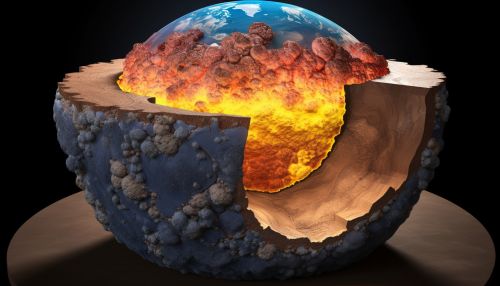
The Science of Earths Inner Structure and Seismic Tomography
Introduction
The Earth's inner structure is a complex and fascinating area of study within the field of geophysics. This article delves into the scientific understanding of Earth's inner structure, with a particular focus on seismic tomography, a method used to image the Earth's interior.
Earth's Inner Structure
The Earth is composed of several layers, each with distinct physical and chemical properties. These layers include the crust, the mantle, the outer core, and the inner core.


The Crust
The crust is the outermost layer of the Earth. It is the thinnest layer, with a thickness that varies from about 5 kilometers in the oceanic crust to about 70 kilometers in the continental crust. The crust is primarily composed of silicate minerals.
The Mantle
Beneath the crust lies the mantle, which extends to a depth of about 2,900 kilometers. The mantle is composed of silicate minerals that are denser than those found in the crust. The mantle can be further divided into the upper mantle and the lower mantle, based on differences in seismic wave velocities.
The Outer Core
The outer core, which extends from the mantle to a depth of about 5,150 kilometers, is believed to be composed of liquid iron and nickel. This liquid outer core is responsible for Earth's magnetic field.
The Inner Core
The inner core, the deepest layer of the Earth, extends from the outer core to the center of the Earth, a depth of about 6,371 kilometers. The inner core is thought to be composed of solid iron and nickel.
Seismic Tomography
Seismic tomography is a technique used to study the Earth's inner structure. It involves the use of seismic waves generated by earthquakes or man-made sources to create a three-dimensional image of the Earth's interior.
Principles of Seismic Tomography
Seismic tomography operates on the principle that seismic waves travel at different speeds through different types of rock. By measuring the time it takes for seismic waves to travel from their source to seismic detectors, scientists can infer the types of rock through which the waves have traveled.
Applications of Seismic Tomography
Seismic tomography has a wide range of applications in geophysics. It is used to study the structure of the Earth's crust and mantle, the dynamics of earthquakes, and the processes that drive plate tectonics. It is also used in the search for oil and gas deposits.
