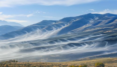
Katabatic winds
Introduction
Katabatic winds are a type of wind that is heavily influenced by gravity. They are also known as fall winds, and are often associated with cold weather phenomena. Katabatic winds originate from high elevations such as hills, mountains, and plateaus where the air is cooler. The cool air is denser than the surrounding air and, as a result, it descends down the slope of the elevation under the force of gravity. This creates a wind that can be quite strong and persistent.


Characteristics of Katabatic Winds
Katabatic winds are characterized by their direction, which is typically down the slope of an elevation, and their cold temperature. They can range in speed from a light breeze to hurricane-force winds, depending on the terrain and atmospheric conditions. Some of the strongest katabatic winds have been recorded in Antarctica, where they can reach speeds of up to 200 miles per hour.
Katabatic winds are also characterized by their persistence. Unlike other types of winds that may change direction or cease altogether, katabatic winds can blow continuously for days or even weeks. This is due to the constant supply of cold air from the high elevations, which continually replenishes the wind as it descends down the slope.
Formation of Katabatic Winds
The formation of katabatic winds begins with the cooling of air at high elevations. This can occur due to radiative cooling, where the air loses heat to the cold ground or snow-covered surface, or adiabatic cooling, where the air cools as it expands while rising in elevation.
Once the air has cooled and become denser than the surrounding air, it begins to descend down the slope of the elevation. This is due to the force of gravity, which pulls the denser air downward. As the air descends, it can pick up speed due to the steepness of the slope and the lack of friction with the ground.
The descending air can also be further cooled by the cold ground or snow-covered surface, which can increase the density of the air and the speed of the wind. This process can create a feedback loop, where the cooling of the air leads to faster and stronger katabatic winds.
Types of Katabatic Winds
There are several types of katabatic winds, each with their own unique characteristics and geographical locations. These include the Mistral, the Bora, the Santa Ana, and the Foehn.
The Mistral is a katabatic wind that occurs in the Rhône Valley in France. It is a cold and dry wind that can reach speeds of up to 60 miles per hour. The Bora is a katabatic wind that occurs along the eastern coast of the Adriatic Sea. It is a cold and dry wind that can reach speeds of up to 100 miles per hour.
The Santa Ana is a katabatic wind that occurs in southern California. It is a hot and dry wind that can reach speeds of up to 70 miles per hour. The Foehn is a katabatic wind that occurs in the Alps. It is a warm and dry wind that can reach speeds of up to 60 miles per hour.
Effects of Katabatic Winds
Katabatic winds can have a significant impact on the local climate and weather patterns. They can bring cold air from high elevations down to lower elevations, which can cause a drop in temperature. This can lead to frost and freeze conditions, which can be harmful to plants and crops.
Katabatic winds can also influence the formation and movement of weather systems. They can push cold air into warmer air, which can cause the warmer air to rise and form clouds and precipitation. This can lead to increased rainfall or snowfall in areas affected by katabatic winds.
In addition to their impact on the climate and weather, katabatic winds can also have an effect on human activities. They can create hazardous conditions for aviation and shipping, due to their strong winds and sudden onset. They can also influence the spread of wildfires, by pushing the fire in the direction of the wind.
