Iranian Plateau
Geography
The Iranian Plateau is a significant geographical feature in Western and Central Asia, spanning across the countries of Iran, Afghanistan, and Pakistan. This plateau is a part of the larger Eurasian Plateau, which also includes the Deccan Plateau in India and the Tibetan Plateau in China. The Iranian Plateau covers an area of approximately 3.6 million square kilometers, making it one of the largest plateaus in the world.


The plateau is characterized by its high altitude, with an average elevation of about 1,000 meters above sea level. It is surrounded by several mountain ranges, including the Zagros Mountains to the west and the Alborz Mountains to the north. These mountains act as a natural barrier, protecting the plateau from the humid winds of the Mediterranean and the Caspian Sea, resulting in a predominantly arid climate.
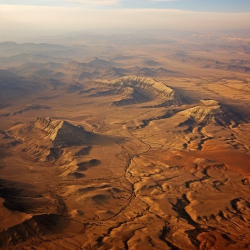
The Iranian Plateau is divided into several regions based on their geographical characteristics. The central part of the plateau is known as the Dasht-e Kavir, or the Great Salt Desert, which is one of the largest salt deserts in the world. To the south of Dasht-e Kavir lies the Dasht-e Lut, or the Lut Desert, which is known for its large sand dunes and is considered one of the hottest places on Earth.
Geology
The geology of the Iranian Plateau is complex and diverse, reflecting its long geological history. The plateau is primarily composed of sedimentary rocks, which were deposited over millions of years by ancient seas and rivers. These sedimentary layers have been folded and faulted due to the tectonic activity, resulting in the formation of the plateau's characteristic mountain ranges and valleys.
The Iranian Plateau is located on the Iranian microcontinent, which is a part of the larger Eurasian tectonic plate. The plateau was formed through a process known as orogeny, or mountain-building, which occurred during the Cenozoic era, approximately 65 million years ago. This process was driven by the collision of the Arabian and Eurasian plates, which caused the uplift of the plateau and the formation of the surrounding mountain ranges.
The plateau is rich in mineral resources, including oil, gas, coal, and various metallic ores. The presence of these resources has played a significant role in the economic development of the region.
Climate
The climate of the Iranian Plateau is predominantly arid, with hot summers and cold winters. This is due to the plateau's high altitude and its location in the interior of the continent, far from the moderating influence of the oceans. However, the climate can vary significantly across the plateau, depending on the altitude and the geographical features.
The central part of the plateau, which includes the Dasht-e Kavir and the Dasht-e Lut, is characterized by its extreme temperatures. During the summer, the temperatures can reach up to 50 degrees Celsius, while in the winter, they can drop below freezing. This region receives very little rainfall, making it one of the driest places on Earth.
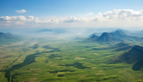
The mountainous regions of the plateau have a different climate, with cooler temperatures and higher rainfall. The Zagros and Alborz mountains receive significant snowfall during the winter, which feeds the rivers and streams that flow into the plateau.
Flora and Fauna
Despite its harsh climate, the Iranian Plateau is home to a diverse range of flora and fauna. The plateau's ecosystems vary from arid deserts to mountainous regions, each with their unique biodiversity.
The central deserts of the plateau, such as the Dasht-e Kavir and the Dasht-e Lut, are home to a variety of desert-adapted species. These include the Persian gazelle, the Asiatic cheetah, and various species of lizards and snakes. The desert vegetation is sparse, consisting mainly of salt-tolerant plants and shrubs.
The mountainous regions of the plateau support a different set of species, including the Persian leopard, the Iranian brown bear, and various species of birds and rodents. These regions are covered by forests of oak, pine, and juniper, which provide habitat for these species.
Human Settlement and Culture
The Iranian Plateau has been inhabited by humans for thousands of years, with evidence of human settlement dating back to the Paleolithic era. The plateau is considered one of the cradles of civilization, with several ancient cultures and empires, such as the Elamites, the Achaemenid Empire, and the Sassanid Empire, having their origins here.
Today, the plateau is home to a diverse range of ethnic groups, including Persians, Kurds, Baloch, and Pashtuns, each with their unique culture and traditions. The plateau's rich cultural heritage is reflected in its numerous historical sites, such as the ruins of Persepolis and the Golestan Palace, which are UNESCO World Heritage Sites.
The Iranian Plateau has played a significant role in the development of Persian literature, art, and architecture. The plateau's landscapes and culture have inspired many Persian poets and artists, such as Hafez, Rumi, and Ferdowsi, whose works are celebrated worldwide.
