Geoarchaeology
Introduction
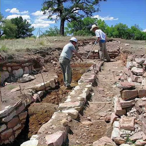
Geoarchaeology is an interdisciplinary field that combines the principles and methodologies of geology and archaeology to study the physical context of archaeological sites. This discipline focuses on understanding the natural processes that affect the formation, preservation, and alteration of archaeological sites and artifacts. By integrating geological techniques and knowledge, geoarchaeologists can reconstruct past landscapes, understand site formation processes, and provide insights into human-environment interactions over time.
Historical Development
The origins of geoarchaeology can be traced back to the early 20th century when archaeologists began to recognize the importance of geological context in interpreting archaeological findings. The field gained significant momentum in the 1960s and 1970s with the advent of new analytical techniques and a growing emphasis on interdisciplinary research. Key figures in the development of geoarchaeology include Karl Butzer, whose work on geomorphology and site formation processes laid the foundation for modern geoarchaeological studies.
Methodologies
Geoarchaeology employs a wide range of methodologies to investigate archaeological sites. These methods can be broadly categorized into field-based techniques, laboratory analyses, and remote sensing technologies.
Field-Based Techniques
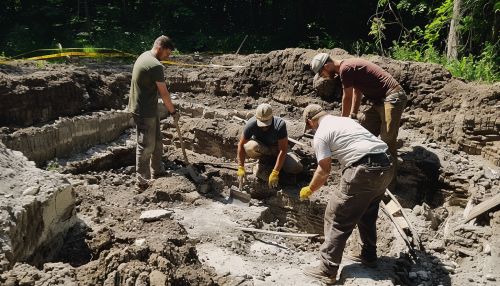
Field-based techniques involve the direct examination of archaeological sites and their surrounding landscapes. Some of the primary field-based methods include:
- **Stratigraphy**: The study of sedimentary layers (strata) to understand the chronological sequence of site formation. Stratigraphic analysis helps in identifying different occupation phases and natural events that have impacted the site.
- **Sedimentology**: The analysis of sediments to determine their origin, composition, and depositional environment. Sedimentological studies can reveal information about past climatic conditions, hydrology, and human activities.
- **Geomorphology**: The study of landforms and the processes that shape them. Geomorphological investigations can provide insights into landscape evolution, erosion patterns, and the impact of natural events such as floods and earthquakes on archaeological sites.


Laboratory Analyses
Laboratory analyses involve the examination of samples collected from archaeological sites to obtain detailed information about their physical and chemical properties. Key laboratory techniques include:
- **Micromorphology**: The microscopic study of soil and sediment samples to identify microstratigraphy, soil formation processes, and anthropogenic activities. Micromorphological analysis can reveal evidence of past human activities, such as hearths, floors, and agricultural practices.
- **Geochemical Analysis**: The examination of the chemical composition of sediments and artifacts to identify sources of materials, trade networks, and environmental conditions. Techniques such as X-ray fluorescence (XRF) and inductively coupled plasma mass spectrometry (ICP-MS) are commonly used in geochemical studies.
- **Paleobotany and Palynology**: The study of ancient plant remains and pollen grains to reconstruct past vegetation and climate. These analyses can provide insights into agricultural practices, diet, and environmental changes.
Remote Sensing Technologies
Remote sensing technologies allow geoarchaeologists to investigate large areas and detect buried archaeological features without direct excavation. Some of the key remote sensing methods include:
- **Ground-Penetrating Radar (GPR)**: A non-invasive technique that uses radar pulses to image subsurface features. GPR is useful for detecting buried structures, graves, and other archaeological features.
- **LiDAR (Light Detection and Ranging)**: A remote sensing method that uses laser pulses to create high-resolution topographic maps. LiDAR can reveal subtle landscape features, such as ancient roads, terraces, and settlement patterns.
- **Satellite Imagery**: The use of satellite images to identify and monitor archaeological sites and landscape changes. Satellite imagery can provide a broad overview of regional archaeological patterns and environmental changes.
Applications
Geoarchaeology has a wide range of applications in archaeological research and heritage management. Some of the key applications include:
Site Formation Processes
Understanding site formation processes is a central focus of geoarchaeology. By studying the natural and anthropogenic factors that influence the preservation and alteration of archaeological sites, geoarchaeologists can reconstruct the history of site occupation and abandonment. This knowledge is crucial for interpreting the archaeological record accurately and for developing effective conservation strategies.
Paleoenvironments
Geoarchaeological studies of paleoenvironments involve reconstructing past landscapes and environmental conditions. By analyzing sediments, soils, and biological remains, geoarchaeologists can infer changes in climate, vegetation, and hydrology over time. This information is essential for understanding how past human societies adapted to and modified their environments.
Geoarchaeological Survey
Geoarchaeological surveys involve the systematic investigation of landscapes to identify and document archaeological sites. These surveys often combine field-based techniques with remote sensing technologies to map and analyze large areas. Geoarchaeological surveys are particularly useful for studying regions with complex geomorphological histories, such as river valleys, coastal zones, and desert landscapes.
Heritage Management
Geoarchaeology plays a critical role in heritage management by providing scientific data for the preservation and protection of archaeological sites. Geoarchaeological studies can inform site management plans, assess the impact of development projects, and guide conservation efforts. By understanding the geological context of archaeological sites, heritage managers can make informed decisions to safeguard cultural heritage for future generations.
Case Studies
Several notable case studies highlight the contributions of geoarchaeology to archaeological research and heritage management.
The Nile Delta
The Nile Delta is a region of significant archaeological and geological interest. Geoarchaeological studies in the Nile Delta have focused on understanding the complex interactions between human societies and the dynamic fluvial environment. Research has revealed how changes in river channels, sedimentation patterns, and sea-level fluctuations have influenced the location and preservation of ancient settlements.
The Maya Lowlands
The Maya Lowlands in Central America are characterized by a diverse range of landscapes, including tropical forests, wetlands, and karstic terrain. Geoarchaeological investigations in this region have provided insights into the environmental challenges faced by the ancient Maya civilization. Studies of soil erosion, water management systems, and agricultural practices have shed light on how the Maya adapted to and modified their environment.
The Great Plains
The Great Plains of North America have been the focus of geoarchaeological research to understand the interactions between prehistoric hunter-gatherer societies and the changing environment. Investigations of alluvial deposits, paleosols, and faunal remains have revealed patterns of human occupation, subsistence strategies, and responses to climatic fluctuations over thousands of years.
Challenges and Future Directions
Geoarchaeology faces several challenges, including the need for interdisciplinary collaboration, the integration of diverse datasets, and the development of new analytical techniques. Future research directions in geoarchaeology include:
- **Advancements in Remote Sensing**: The continued development of remote sensing technologies, such as high-resolution LiDAR and hyperspectral imaging, will enhance the ability to detect and analyze archaeological features and landscapes.
- **Climate Change Studies**: Geoarchaeology can contribute to understanding the long-term impacts of climate change on human societies by examining past environmental changes and human responses. This knowledge can inform contemporary discussions on climate adaptation and resilience.
- **Digital Geoarchaeology**: The integration of digital tools, such as Geographic Information Systems (GIS) and 3D modeling, will facilitate the analysis and visualization of complex geoarchaeological data. Digital geoarchaeology can enhance the accessibility and dissemination of research findings.
Conclusion
Geoarchaeology is a dynamic and evolving field that bridges the gap between geology and archaeology. By applying geological principles and techniques to archaeological research, geoarchaeologists can uncover valuable information about past human-environment interactions, site formation processes, and landscape evolution. As the field continues to advance, geoarchaeology will play an increasingly important role in understanding and preserving the archaeological record.
