Argo (oceanography)
Overview
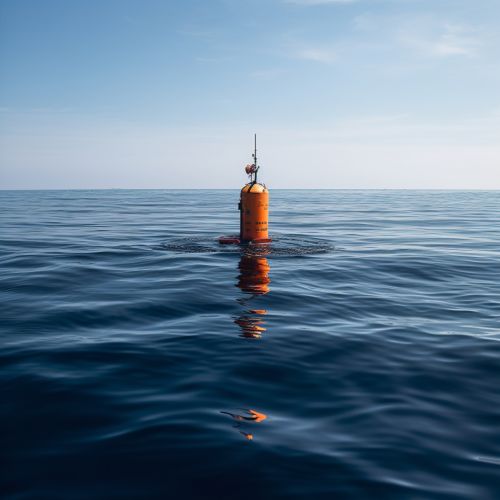
The Argo is a global array of 3,800 free-drifting profiling floats that measures the temperature and salinity of the upper 2000 meters of the ocean. This allows, for the first time, continuous monitoring of the temperature, salinity, and velocity of the upper ocean, with all data being relayed and made publicly available within hours after collection.
History
The Argo program, named after the mythical Greek ship Argo, was initiated in the late 1990s and began deploying floats in 2000. By November 2007, the array reached its initial goal of 3000 floats. The program is a collaborative partnership of more than 30 nations, coordinated by the Argo Steering Team.
Design and Function
Each Argo float weighs about 20 kilograms and is roughly cylindrical, with a diameter of about 20 centimeters and a height of about 1.3 meters. The floats are designed to drift at a fixed pressure (usually corresponding to a depth of 1000 meters) for ten days, then descend to a pressure corresponding to 2000 meters depth, collect profiles of pressure, temperature, and salinity data as they rise, and then transmit the data to satellites when they reach the surface.
Data Collection and Usage
Argo data are freely available to both the scientific community and the public, and are used for a variety of applications. These include improving ocean, weather, and climate forecasts; initializing ocean and coupled ocean-atmosphere forecast models; validating satellite altimeter measurements; and providing a scientific basis for climate and oceanographic research.
Impact and Significance
The Argo program has revolutionized oceanography, providing data that are critical for understanding the ocean's role in climate. It provides a quantitative description of the changing state of the upper ocean and the patterns of ocean climate variability from months to decades, including heat and freshwater storage and transport.
Future Developments
The future of the Argo program includes enhancements such as expanding coverage into high-latitude ice-covered regions, increasing vertical resolution in the upper 200 meters, extending measurements into the deeper ocean, and adding biogeochemical sensors.
See Also


