River channel: Difference between revisions
(Created page with "==Introduction== A river channel, also known as a fluvial channel, is the physical confine of a river, consisting of a bed and banks. It is the path through which the water in a river flows. River channels are significant features in geomorphology, hydrology, and environmental management due to their role in shaping landscapes and ecosystems. <div class='only_on_desktop image-preview'><div class='image-preview-loader'>...") |
No edit summary |
||
| Line 2: | Line 2: | ||
A river channel, also known as a [[Fluvial process|fluvial]] channel, is the physical confine of a river, consisting of a bed and banks. It is the path through which the water in a river flows. River channels are significant features in [[Geomorphology|geomorphology]], [[Hydrology|hydrology]], and environmental management due to their role in shaping landscapes and ecosystems. | A river channel, also known as a [[Fluvial process|fluvial]] channel, is the physical confine of a river, consisting of a bed and banks. It is the path through which the water in a river flows. River channels are significant features in [[Geomorphology|geomorphology]], [[Hydrology|hydrology]], and environmental management due to their role in shaping landscapes and ecosystems. | ||
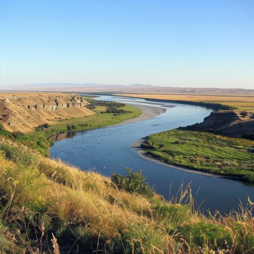
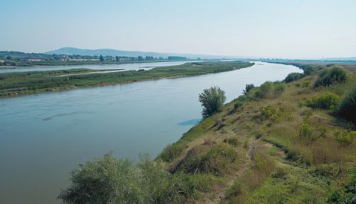
[[Image:Detail-77641.jpg|thumb|center|A wide river flowing through a landscape, with visible banks on both sides.|class=only_on_mobile]] | |||
[[Image:Detail-77642.jpg|thumb|center|A wide river flowing through a landscape, with visible banks on both sides.|class=only_on_desktop]] | |||
==Formation and Types of River Channels== | ==Formation and Types of River Channels== | ||
Latest revision as of 21:17, 6 May 2024
Introduction
A river channel, also known as a fluvial channel, is the physical confine of a river, consisting of a bed and banks. It is the path through which the water in a river flows. River channels are significant features in geomorphology, hydrology, and environmental management due to their role in shaping landscapes and ecosystems.


Formation and Types of River Channels
River channels are formed through the process of erosion and sediment deposition. The nature of a river channel, including its shape, size, and pattern, is determined by a variety of factors such as the volume and velocity of water flow, the type and amount of sediment load, and the characteristics of the river's catchment area.
There are several types of river channels, each with distinct characteristics:
Straight Channels
Straight channels are relatively rare in nature and are typically short and found in the upper course of a river. They are characterized by a single, straight flow path.
Meandering Channels
Meandering channels are winding or sinuous in form. They are common in the middle and lower courses of a river, where the gradient is less steep and sediment load is higher.
Braided Channels
Braided channels consist of a network of small channels separated by small and often temporary islands called braid bars or, in British usage, aits or eyots.
Anastomosing Channels
Anastomosing channels consist of multiple channels that divide and recombine, and are separated by stable islands.
River Channel Morphology
The morphology of a river channel refers to its shape and structure, which are influenced by a variety of factors including the river's flow regime, sediment load, and the geology of the river bed and banks.
Channel Pattern
The channel pattern refers to the layout or arrangement of a river channel within its valley. This can be straight, meandering, braided, or anastomosing, as mentioned above.
Channel Profile
The channel profile refers to the longitudinal (from source to mouth) and cross-sectional (across the channel) shape of a river channel.
Channel Dimensions
The dimensions of a river channel include its width, depth, and cross-sectional area. These dimensions can vary greatly depending on the river's flow regime, sediment load, and the geology of the river bed and banks.
River Channel Processes
River channels are dynamic systems that are constantly changing due to a variety of processes. These include erosion, transport, and deposition of sediment.
Erosion
Erosion is the process by which rock and soil are worn away by the action of water, wind, or ice. In river channels, erosion occurs primarily through the action of flowing water and the sediment it carries.
Transport
Transport refers to the movement of sediment within the river channel. This can occur through a variety of mechanisms, including suspension (where sediment is carried within the water column), saltation (where sediment 'hops' along the river bed), and traction (where sediment rolls along the river bed).
Deposition
Deposition is the process by which sediment is laid down or settles out of the water column. This typically occurs in areas of the river channel where the velocity of the water decreases, such as on the inside of meanders or in the lower course of the river.
River Channel Management
River channel management involves the application of various strategies and techniques to manage the impacts of human activities on river channels and to mitigate the effects of natural hazards such as flooding.
Channelization
Channelization is a commonly used technique that involves modifying the river channel to improve navigation, control floods, or drain wetlands. This can involve straightening the river channel, deepening it, or lining it with concrete.
River Restoration
River restoration involves the application of ecological principles to restore degraded river ecosystems to a more natural state. This can involve measures such as removing artificial structures, reintroducing native species, and recreating natural flow regimes.
Flood Management
Flood management involves the use of various strategies to reduce the risk and impact of floods. This can involve structural measures such as the construction of levees or floodwalls, and non-structural measures such as land use planning and flood forecasting.
