Oquirrh Mountains
Geography
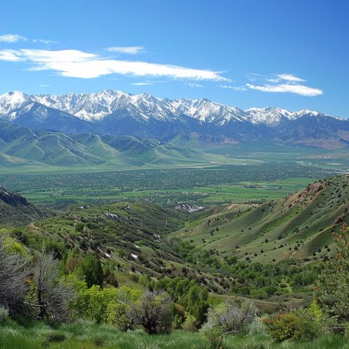
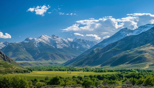
The Oquirrh Mountains are a prominent mountain range located in the north-central part of the state of Utah, United States. Stretching approximately 30 miles (48 km) in length and about 15 miles (24 km) in width, the range forms a natural barrier between the Salt Lake Valley to the east and the Tooele Valley to the west. The highest peak in the Oquirrh Mountains is Flat Top Mountain, which reaches an elevation of 10,620 feet (3,237 meters).


Geology
The Oquirrh Mountains are primarily composed of sedimentary rock formations, including limestone, sandstone, and shale. These formations date back to the Paleozoic Era, specifically the Permian and Pennsylvanian periods. The range was uplifted during the Sevier Orogeny, a mountain-building event that occurred approximately 140 to 50 million years ago. The geological structure of the Oquirrh Mountains is characterized by extensive faulting and folding, which has exposed a variety of mineral deposits.
Mineral Resources
The Oquirrh Mountains are rich in mineral resources, particularly copper, gold, silver, and lead. The most notable mining operation in the range is the Bingham Canyon Mine, also known as the Kennecott Copper Mine. This open-pit mine is one of the largest and most productive copper mines in the world. The extraction of these minerals has played a significant role in the economic development of Utah and has contributed to advancements in mining technology and environmental management practices.
Flora and Fauna
The Oquirrh Mountains support a diverse range of flora and fauna, adapted to the varying elevations and climatic conditions of the range. The lower elevations are characterized by sagebrush and juniper woodlands, while the higher elevations support aspen, fir, and pine forests. The range is home to a variety of wildlife species, including mule deer, elk, mountain lions, and golden eagles. The unique ecological zones within the Oquirrh Mountains provide important habitats for both resident and migratory species.
Hydrology
The hydrology of the Oquirrh Mountains is influenced by the region's semi-arid climate and the presence of numerous streams and springs. The range serves as a critical watershed for the surrounding valleys, contributing to the water supply for agricultural, industrial, and residential use. Notable water bodies originating from the Oquirrh Mountains include the Jordan River and several tributaries that feed into the Great Salt Lake. The management of water resources in the area is essential for maintaining the ecological balance and supporting human activities.
Human History
The Oquirrh Mountains have a rich human history, with evidence of Native American habitation dating back thousands of years. The range was historically inhabited by the Goshute and Ute tribes, who utilized the area's natural resources for hunting, gathering, and tool-making. European exploration and settlement began in the mid-19th century, with the establishment of mining operations and the development of infrastructure to support the growing population. The discovery of valuable mineral deposits attracted prospectors and settlers, leading to the establishment of towns and communities in the region.
Modern Development
In contemporary times, the Oquirrh Mountains continue to be a focal point for mining activities, particularly in the Bingham Canyon Mine. Advances in mining technology have allowed for more efficient extraction of minerals while also addressing environmental concerns. Additionally, the range is a popular destination for outdoor recreation, including hiking, camping, and wildlife observation. Efforts to balance economic development with environmental conservation are ongoing, with various stakeholders working to ensure the sustainable use of the Oquirrh Mountains' natural resources.
